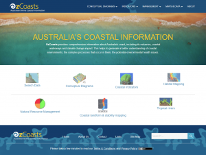
OzCoasts provides comprehensive information about Australia’s coast, including its estuaries and coastal waterways. This helps to generate a better understanding of coastal environments, the complex processes that occur in them, the potential environmental health issues and how to recognise and deal with these issues. More about us ...


What's New

Landform & stability maps module

Nationally-consistent coastal geomorphology and stability maps in segmented line format and beach information

Beach conceptual models

Australia beaches (Wave-dominated, Tide-modified, Tide-dominated, & Beaches plus rock/reef flats.)

Natural Resource Management module

The Environmental Management and the NRM Reporting modules have been merged in the Natural Resource Management module.

What's Next

Climate change module

Climate Change module will be released in the mid February.

Coastal Eutrophication Risk Assessment Tool

CERAT developed by The NSW Department of Environment, Climate Change and Water will have a web application here soon.

Beach search

Search Australian beaches according to geomorphic type at a range of spatial scales (National, states, NRM regions, local government areas and bioregions)

NSW marine habitat mapping

With case studies ...


Landform & Stability Maps
Coastal landform & stability maps
Introduction
Smartline maps
Reports and data


Search data Search data
Simple search, Estuary search, Map search. Coastal information, Coastal stakeholder, Regional plans & strategies. Publications


Conceptual modelsConceptual models
Wetland classification, Estuarine typology, Beach typology, Science models, Estuarine biophysical models, Beach geomorphic models, Process models, Threat models, Stressors models.
Build your own model

Coastal indicatorsCoastal indicator factsheets
Beach erosion, Climate change, Sea level rise, Biodiversity, Mangrove areas, Dissolved oxygen, Hermit crabs, Turbidity, Water temperature, Nutrients, Eutrophication, Toxicants, Salt marsh areas, Salinity, Seagrass areas, Beach & dune areas, Shorebird, Sedimentation rates, more ...


Habitat MappingHabitat mapping
Coastal water habitat mapping toolkit: Benthic habtat mapping, Techniques, Case studies, Decision tree
Interactive 3D Models: Cockburn Sound, Keppel Bay and Fitzroy River Area, Sydney Harbour, Woody Island.

NRM reportingNatural resource management
Report cards, Habitat extent
Australian shallow waters spectral library
Environmental Management Framework, Numerical modelling tool links
Stressors: Altered pH, Disturbance to Biota, Hydrodynamic alterations, ...

Back to top of page


  • Link to the Geoscience Australia website  (new window)